Topographic Surveys & 3D Terrain Mapping
Survey-grade topographic mapping captured with a Trimble laser scanner — millions of measured points in one site visit, delivered as contours, terrain models, and CAD-ready base maps your design team can build on.
A Complete Site in a Single Visit
Survey-grade topographic mapping for East Bay and Bay Area properties, captured with a Trimble terrestrial laser scanner (TLS). Where a conventional topo crew records a few hundred shots with a total station, our scanner captures millions of measured points in a single site visit — every grade break, retaining wall, tree, utility feature, and structure — then we extract a clean, CAD-ready base map from the point cloud. The result is a topographic survey your architect or civil engineer can design on without callbacks for missed shots: contours at the interval your project needs, a digital terrain model (DTM), spot elevations, and surface utility features, delivered as DWG/DXF with the underlying point cloud available for the design team. Topographic surveys are required or effectively required for hillside permits, additions and ADUs, grading and drainage design, retaining wall engineering, and most civil site design in Oakland, Berkeley, and surrounding East Bay jurisdictions.
- Trimble laser scanning: millions of points, one site visit
- Contours, DTM, and spot elevations at any interval
- CAD-ready DWG/DXF base maps for architects and engineers
- No return trips for missed shots — the scan has everything
- Vegetation-filtered ground models on brushy hillside lots
- Point cloud deliverable available for design teams
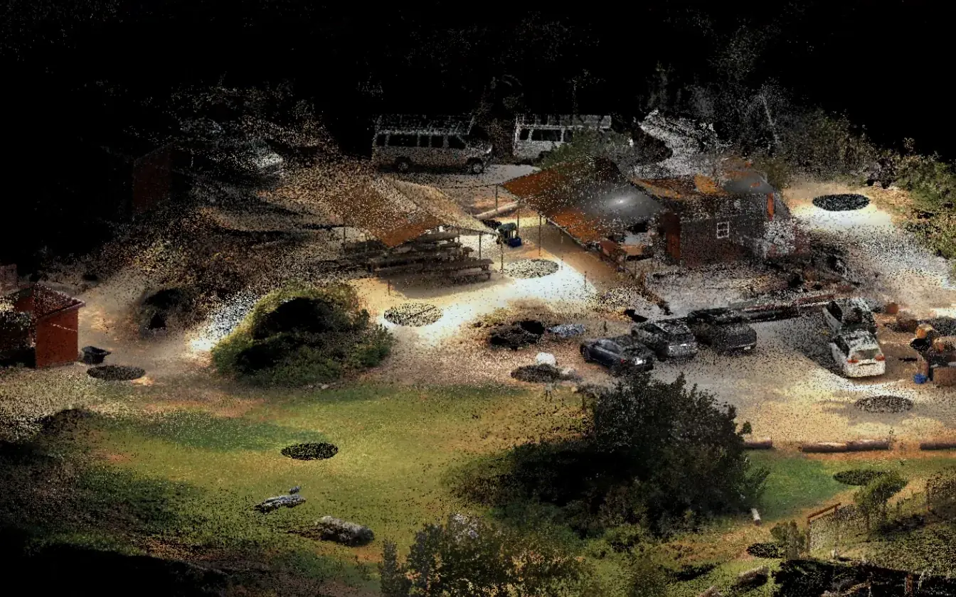

Topographic Survey
Ground surface mapped for grading and design.
Contours, spot elevations, and site features delivered as a CAD-ready base map.
Typical Deliverables
Layered DWG/DXF topographic base map
Contours at 1-foot (or project-specified) interval
Digital terrain model (DTM) and spot elevations
Registered point cloud (E57/RCP) on request
Scope & Research
We confirm the mapping limits, contour interval, and datum your project requires, and review record maps and benchmarks for the site.
Field Scanning
We capture the site with a Trimble terrestrial laser scanner plus GNSS/total-station control, recording millions of survey-grade points in a single visit — terrain, structures, walls, trees, and utility surface features.
Point Cloud Processing
Scans are registered onto project control, vegetation and noise are filtered, and a ground surface is extracted to build the digital terrain model.
Base Map Delivery
You receive a layered DWG/DXF topographic base map — contours, spot grades, features, and boundary if requested — with the point cloud available on request.
Topographic Surveys FAQ
Site Plan Surveys
Stamped site plan surveys, boundary + topographic base maps, and existing-condition documentation for Bay Area permit submittals.
As-Built Surveys
Accurate as-built documentation of existing buildings and sites, captured with a Trimble terrestrial laser scanner and delivered as 2D CAD drawings, 3D linework, or registered point clouds.
ADU Surveys
Pre-construction surveys for accessory dwelling units across the East Bay — the scaled site plan, boundary verification, and topographic data Bay Area cities require before an ADU permit application is accepted.
Topographic Surveys Across Northern California
Local conditions, permitting, and county recording differ city to city — see how we handle topographic surveys where your project is:
Need a Topographic Survey?
Tell us about your site and permit requirements — we'll quote a laser-scanned topo with the deliverables your design team needs.
Meeting-first estimates • Response within 24 hours • Serious projects only