3D Laser Scanning & As-Built Documentation
Capture existing conditions once and give every stakeholder a reliable source of truth. We provide surveyor-led high-density point clouds, CAD drawings, Revit-ready models, and visual 3D deliverables for architects, engineers, contractors, owners, churches, institutions, and preservation teams.
Bay Area 3D Laser Scanning Surveyor for Existing Conditions
Renovations, retrofits, tenant improvements, preservation work, ADA corrections, and condo conversions all depend on one thing: knowing what is already there. We capture the site once and turn it into deliverables your architects, engineers, contractors, owners, and consultants can use without repeated field visits.
For Bay Area and Northern California teams, that means surveyor-led terrestrial laser scanning tied to control, then processed into registered point clouds, scan-to-CAD drawings, 2D as-built plans, elevations, sections, and BIM-ready files.
- 3D + 2D deliverables for complete understanding
- Millimeter-accurate measurements
- Interactive 3D models anyone can navigate
- Traditional 2D plans for permitting and design
- Scan-to-CAD and Scan-to-BIM workflows
- Complete as-built documentation
- Point cloud deliverables
- BIM-ready data
- Non-invasive data collection
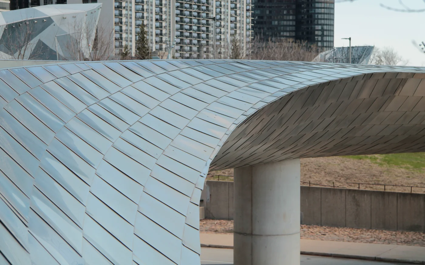
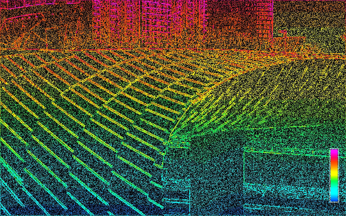
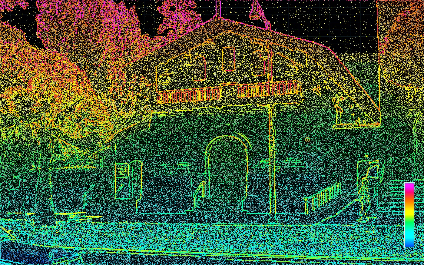
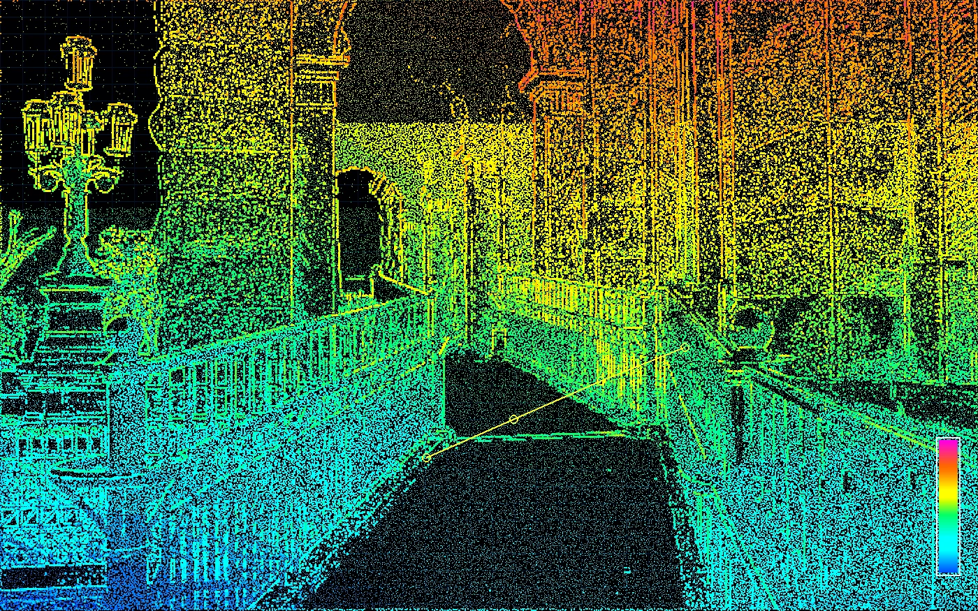
Reality Capture
Point clouds that become usable project files.
High-density scan data supports CAD, BIM-ready modeling, field verification, and existing-condition coordination.
Modern Surveyor-Led Scanning
Reality capture that feels technical before it ever feels generic.
The site is shifting toward clients who value expertise: architects, engineers, developers, churches, institutions, attorneys, owners, and contractors with complicated existing conditions. The work starts with a scope meeting so the deliverable matches the risk, not a guessed-at line item.
01
Point cloud capture
Dense existing-condition data captured once for the building, site, route, or disputed area.
02
CAD and model production
Floor plans, sections, elevations, surface data, or BIM-ready geometry built around the actual scope.
03
Surveyor interpretation
Boundary, ADA, construction, and legal context added where a scan alone is not enough.
Northern CA
Hwy 50 / 80 corridor focus
Licensed CA PLS
Survey judgment behind the data
Meeting first
Estimate after real scoping
Deliverables for scanning projects
Clients searching for a 3D laser scanning surveyor usually need more than a pretty point cloud. The value is a deliverable package that reduces risk for design, pricing, permitting, construction coordination, due diligence, or legal review.
Point clouds
Registered, cleaned point cloud data for measurement and coordination.
Scan-to-CAD
Floor plans, elevations, sections, and site geometry drafted from the scan.
BIM-ready models
Revit-ready or model-ready information for AEC teams when the scope calls for it.
Visual 3D records
Interactive context so owners and consultants can understand the site without reading every plan.
Common Bay Area scanning needs
- 3D laser scanning surveyor Bay Area
- Point cloud survey for architects
- As-built documentation for renovation
- Scan-to-CAD and scan-to-BIM services
- Historic building 3D scanning
- ADA ramp as-built measurement
Best-Fit Scanning Projects
Scanning is strongest where buildings are complex, old drawings are unreliable, or small measurement errors create expensive downstream risk.
Architecture & Engineering
Base drawings, sections, elevations, and models for renovation and retrofit design.
Historic Preservation
Non-invasive documentation of facades, interiors, stairs, ornament, and irregular geometry.
ADA & Accessibility
As-built slope, landing, route, threshold, and transition data for review or correction.
Condo Conversions
Interior and exterior documentation to support unit plans, common areas, and conversion teams.
Our Process
From field scanning to 3D models and 2D plan sets — deliverables your whole team can use.
Project Planning
We assess your site and requirements to plan optimal scan positions and deliverable specifications.
Field Scanning
Our technicians capture millions of precise 3D points using state-of-the-art laser scanners.
Data Processing
Scan data is registered, cleaned, and processed into unified point clouds.
Deliverable Creation
We produce both interactive 3D models for easy visualization and traditional 2D plan sets — so every stakeholder can understand the site, whether they read blueprints or not.
3D Scanning FAQ
Common questions about 3D laser scanning.
Related Services
Other data capture services.
Site Plan Surveys
Stamped site plan surveys, boundary + topographic base maps, and existing-condition documentation for Bay Area permit submittals.
Learn MoreDeformation Monitoring
Track structural deformation, settlement, and site movement using a combination of high-density 3D laser scanning and precise survey control.
Learn MoreConstruction Staking
Translate design plans into precise field locations for construction.
Learn MoreNeed 3D Scanning Services?
Contact us to discuss your project. We'll recommend the best approach for your needs.
Meeting-first estimates • Response within 24 hours • Serious projects only