Deformation & Settlement Monitoring Survey
Repeatable, survey-grade deformation and settlement monitoring for distressed structures, buildings next to excavation, retaining walls, and moving slopes. Every epoch is observed from the same control network, so movement is measured against a baseline instead of estimated. Performed under PLS 9686. We do no repair or shoring work, so the numbers carry no commercial interest.
What a Deformation Monitoring Survey Is
Deformation monitoring is the repeated measurement of a structure or a piece of ground from a fixed control network, so that movement over time can be quantified rather than argued about. One visit produces a description of a building. Two or more visits on the same control produce a measurement of change, which is the only thing a structural or geotechnical engineer can act on.
Settlement monitoring is the vertical case of the same method, and it is the one most owners arrive with. Crack monitoring, tilt, convergence, and slope movement are the same exercise applied to different geometry. Whichever it is, the value lives in the baseline: it has to be observed before the event you are worried about, and every later epoch has to return to the same control.

Movement Monitoring
Baseline and repeat measurements for changing sites.
Track movement, settlement, construction impacts, or structural change with repeatable measurements.
When Engineers Require Monitoring
Most of this work arrives because a report, a permit condition, or a neighbor's excavation asked for it.
A distress report
Cracking, settlement, or a sloping floor has been found and the engineer needs to know whether it is still moving. A baseline epoch plus a second observation answers that. A single visit cannot.
Adjacent excavation and shoring
Excavation, shoring, dewatering, or pile driving next door can move your building. The baseline has to exist before the neighbor breaks ground, because afterward there is nothing to compare against.
Insurance and litigation
Claims turn on the condition of a structure on a given date. A stamped epoch on a documented control network is measurement that survives the other side’s engineer.
Slopes, walls, and levees
Retaining walls, cut slopes, creeping hillsides, and Delta levee crests move slowly and seasonally. Whole-surface comparison shows where and how fast, which a handful of stakes will not.
Post-repair verification
After underpinning, piers, or a retrofit, the engineer wants evidence the movement stopped. Repeat epochs against the pre-repair baseline provide it.
Sensitive existing structures
Historic buildings, hospitals, and plants where tolerances are tight and a surprise is expensive. Monitoring converts an assumption about stability into a measured record.
Method: Control, Registration, and the Epoch
Accuracy in this work has three layers, and only the third one decides whether a monitoring program means anything. Instrument accuracy is what a total station or a scanner achieves on a single measurement, and every vendor's hardware is capable of it. Registration accuracy is whether the observations agree with each other across a whole structure, which is where small alignment errors quietly compound. Control accuracy is whether the dataset agrees with the world, and with the last epoch. A monitoring survey without a control network is a very detailed picture of a building on one day.
So the control network comes first, set on stable ground outside the suspected movement, observed with redundancy and adjusted so each point carries an error estimate rather than an assumption. Epochs are observed from that network with a Trimble S3 total station for discrete monitoring points and a Trimble X9 scanner where full-surface comparison is wanted, processed in Trimble Business Center, with independent check points that were not used in the adjustment observed on every visit. Movement is reported relative to project survey control, with relative control held to better than 0.01 US survey feet, typically inside 0.005 feet where the network is good, and the achieved closures stated in each report. Where a program demands tighter angular work than that, the instrument changes with it rather than the claim. The detection threshold for a given structure is agreed in writing before the baseline, because it depends on network geometry, sight distances, and what the building allows for setups.
Repeatability is the discipline that makes the numbers comparable. The same control, the same point set, the same instrumentation, and where practical the same time of day, so that a difference between epochs is movement rather than a change of method. Where a building interior is the subject, the baseline is often a floor level survey on the same control. For structures and corridors see infrastructure scanning and 3D laser scanning.
What You Receive Each Epoch
A report an engineer can act on, and a record that holds up when someone disputes it.
Per-epoch movement report
Each monitoring point compared against the baseline and against the prior epoch, with the movement in each component, the date and time of observation, and the conditions. Trends across epochs are shown, not just the latest reading.
Surface comparison
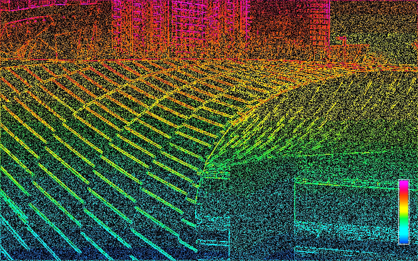
Where scanning was used, a difference surface between epochs showing where the structure or slope moved and by how much, rather than interpolation between a few prism points.
Control and tolerance statement
The control network, the observation method, the instrumentation, and the achieved tolerance relative to project survey control, plus the residuals on independent check points that were not used in the adjustment.
Threshold and escalation record
The action thresholds the engineer set, whether any were exceeded, and when you were notified. Thresholds are agreed before the baseline, not after a reading looks bad.
Our Process
Control network, baseline, repeat epochs, and a report that states what was achieved.
Control Network
We set a control network on stable ground outside the suspected movement, observed with redundancy so each point carries an error estimate. Every later epoch is observed from that same network, which is what makes two dates comparable.
Baseline Epoch
Monitoring points, crack gauges, and full-surface scans are observed against the control to establish the baseline. On adjacent-construction work the baseline is captured before the first excavation, because a baseline taken afterward proves nothing.
Repeat Epochs
The structure or slope is re-observed on the interval the engineer specified, from the same control, with the same instrumentation and the same point set, so an apparent change is real movement rather than a change of method.
Movement Report
Each epoch is differenced against the baseline and the prior epoch. You receive per-point movement, a surface comparison where scans were used, the trend across epochs, and a statement of the tolerance achieved relative to project survey control.
Service Area
We take monitoring work across Northern California, roughly within three hours of Sacramento: the Sacramento region and the Delta margin, the Sierra foothills from Auburn through Placerville, the northern Central Valley, and the San Francisco Bay Area. Monitoring programs need someone who can return on a schedule, so travel distance is part of how we scope them. See our Sacramento deformation monitoring page for the regional specifics.
Deformation Monitoring FAQ
Common questions from structural and geotechnical engineers, owners, and counsel.
Related Services
Often ordered alongside monitoring. For work required during construction, see our construction certification surveys.
3D Scanning
Capture existing conditions once and give every stakeholder a reliable source of truth.
Learn MoreBridge & Infrastructure Scanning
Survey-grade 3D laser scanning for bridges, overcrossings, tunnels, tanks, rail and roadway corridors, plants, and utility structures, tied to a least-squares-adjusted control network so every point carries a known accuracy.
Learn MoreFloor Level Survey
Independent, survey-grade floor level surveys for structural engineers, HOAs, property managers, and owners across Northern California.
Learn MoreDeformation Monitoring Across the Bay Area
Local conditions, permitting, and county recording differ city to city — see how we handle deformation monitoring where your property is:
Send Us the Engineer's Scope
Tell us what is moving, what the thresholds are, and how often it has to be observed. We will scope the control network and the epoch schedule. (510) 543-2220 · info@contour-survey.com
Meeting-first estimates • Response within 24 hours • Serious projects only